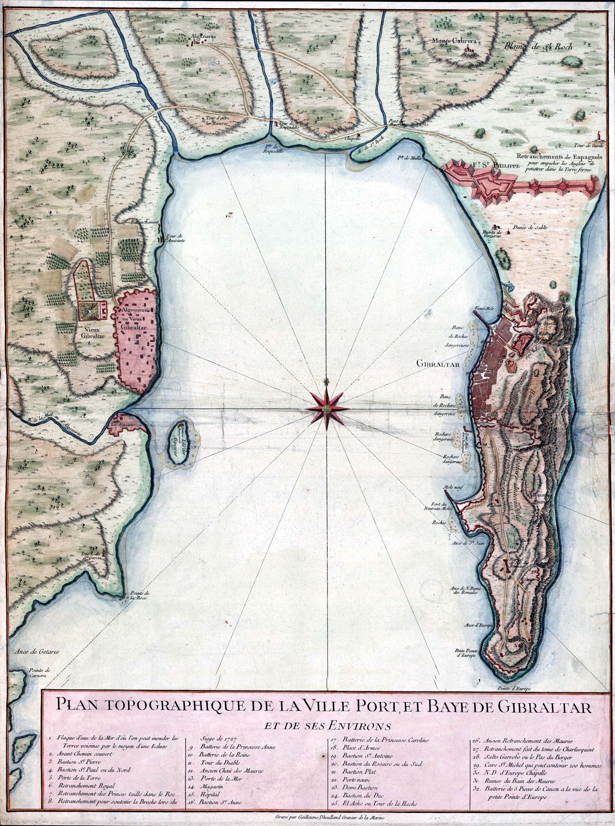
Gibraltar and Bay map 1750

Forfatter/Opretter:
Guillaume Dheulland (1700–1770)
Shortlink:
kilde:
størrelse:
2049 x 2750 Pixel (898443 Bytes)
beskrivelse:
Topographic map of Gibraltar and the Bay of Gibraltar, circa 1750
Licens:
Public domain
Yderligere oplysninger om licens til billedet kan findes her. Sidste ændring: Fri, 11 Apr 2025 14:13:55 GMT