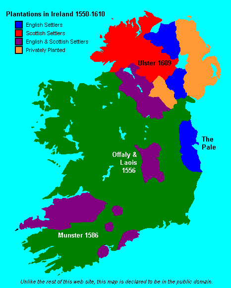
Map of British plantations of Ireland, 1550–1610

Forfatter/Opretter:
www.wesleyjohnston.com
Kredit:
Proximally, from GIF version; ultimately, from http://www.wesleyjohnston.com/users/ireland/maps/historical/map1609.gif
Shortlink:
kilde:
størrelse:
466 x 565 Pixel (7608 Bytes)
beskrivelse:
Map showing the major British crown-organised and private-sector "plantations" (colonies) in Ireland from ca. 1550 to 1610. Colour-coded as to Scottish, English or a mixture (other than it is not clear that the privately organized plantations in Ulster varied in composition, but heavy toward the Scots side). This file is supplied as requested PNG replacement for an undesirable GIF, though the entire thing would be better redone as an SVG.
Licens:
Public domain
Kommentar på licensen:
Public domain by declaration of original creator (see notice at bottom of original GIF-format upload)
Yderligere oplysninger om licens til billedet kan findes her. Sidste ændring: Wed, 07 Aug 2024 11:14:28 GMT