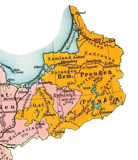
Map of East Prussia 1648
Kredit:
F. W. Putzgers Historischer Schul-Atlas, 1905
Shortlink:
kilde:
størrelse:
478 x 554 Pixel (77302 Bytes)
beskrivelse:
Map of East Prussia 1648
Licens:
Public domain
Yderligere oplysninger om licens til billedet kan findes her. Sidste ændring: Tue, 11 Feb 2025 15:13:56 GMT