Medieval Arab Palestine
Forfatter/Opretter:
The original uploader was Mustafaa at engelsk Wikipedia.
Later versions were uploaded by AnonMoos at en.wikipedia.
Kredit:
Transferred from en.wikipedia to Commons.
Shortlink:
kilde:
størrelse:
824 x 1064 Pixel (195077 Bytes)
beskrivelse:
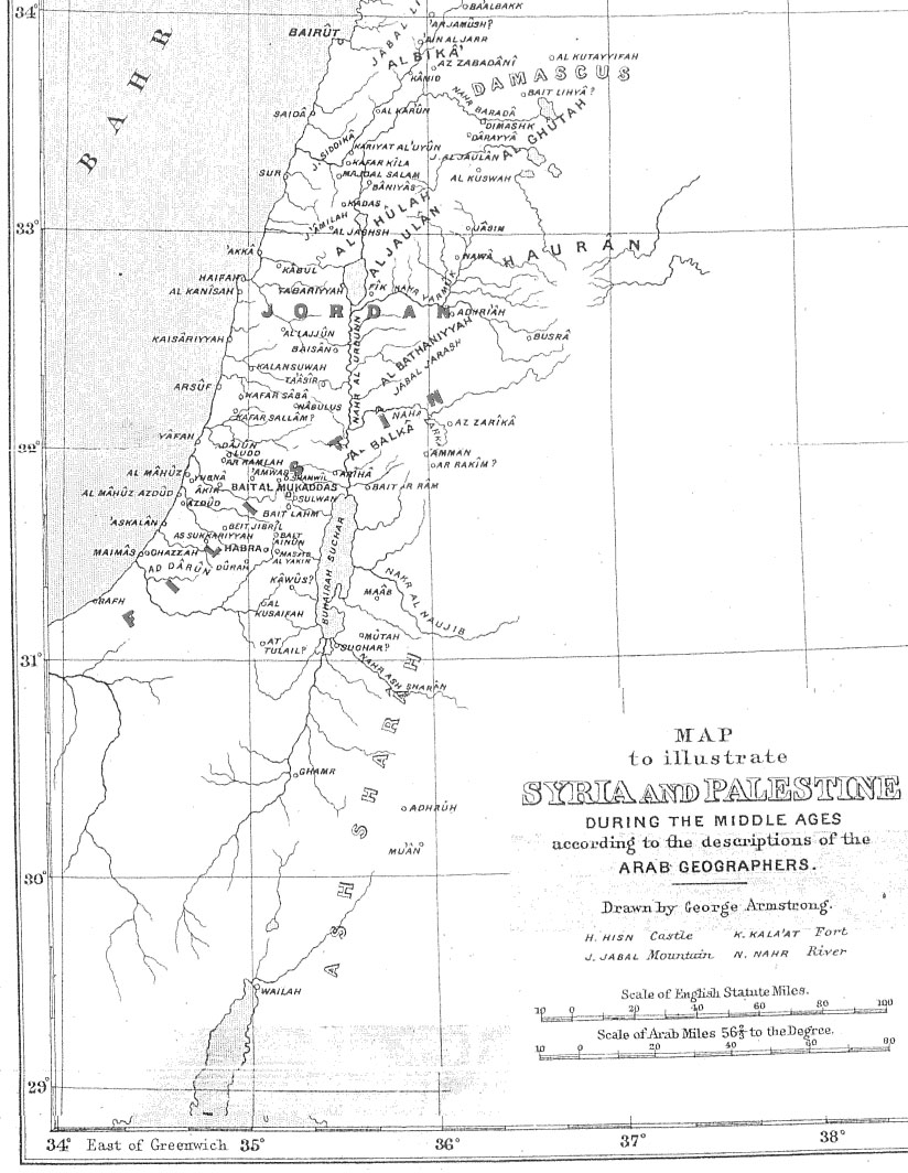
Map of Palestine during the Middle Ages according to the description of the Arab geographers, drawn by Geo. Armstrong, from Palestine Under the Muslims: A Description of Syria and the Holy Land from AD 650 to 1500, by Guy Le Strange, London 1890. Note that only a limited area was called "Palestine" ("Filistin") in Arabic during the Caliphate period.
Licens:
Public domain
Yderligere oplysninger om licens til billedet kan findes her. Sidste ændring: Tue, 15 Apr 2025 22:50:57 GMT