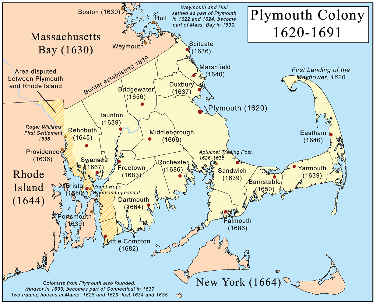
Plymouthcolonymap
Forfatter/Opretter:
Attribution:
Billedet er tagget "Attribution Required", men der blev ikke angivet nogen tilskrivningsoplysninger. Attributionsparameteren blev sandsynligvis udeladt ved brug af MediaWiki-skabelonen til CC-BY-licenserne. Forfattere og ophavsmænd finder et eksempel på korrekt brug af eksempel her. her.
Kredit:
Own work using:
- The Border is Where? Part II
- The Survey System of the Old Colony
- Timeline of Plymouth Colony
- Rootsweb - Plymouth County towns
- Rootsweb - Barnstable County
- CapeCodHistory.us
- Rootsweb - Bristrol County towns
- Rootsweb - Rhode Island counties
- Rochester (MA) Town History
- Barrington, RI history
- Little Compton Historical Society
- The History of Cumberland
- RIEDC - Town of Bristol
- History of Weymouth
- Massachusetts City and Town Incorporation and Settlement Dates
Shortlink:
kilde:
størrelse:
1235 x 1000 Pixel (674763 Bytes)
beskrivelse:
This is a map of Plymouth Colony that I made.
Licens:
Licensbetingelser:
Creative Commons Attribution-Share Alike 3.0
Yderligere oplysninger om licens til billedet kan findes her. Sidste ændring: Mon, 06 Jan 2025 17:37:20 GMT